


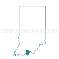
CLARK 01, Perry County, Indiana
About
Outline

Summary
| Unique Area Identifier | 580016 |
| Name | CLARK 01 |
| County | Perry County |
| State | Indiana |
| Area (square miles) | 29.30 |
| Land Area (square miles) | 29.26 |
| Water Area (square miles) | 0.04 |
| % of Land Area | 99.87 |
| % of Water Area | 0.13 |
| Latitude of the Internal Point | 38.14838260 |
| Longtitude of the Internal Point | -86.72712530 |
Maps


Graphs
Select a template below for downloading or customizing gragh for CLARK 01, Perry County, Indiana


Neighbors
Neighoring Voting District (by Name) Neighboring Voting District on the Map
- ANDERSON, Perry County, IN
- CLARK 02, Perry County, IN
- HARRISON 01, Spencer County, IN
- HARRISON 02, Spencer County, IN
- LEOPOLD, Perry County, IN
- OIL, Perry County, IN
Top 10 Neighboring County Subdivision (by Population) Neighboring County Subdivision on the Map
- Oil township, Perry County, IN (2,546)
- Harrison township, Spencer County, IN (2,000)
- Anderson township, Perry County, IN (1,557)
- Clark township, Perry County, IN (1,180)
- Leopold township, Perry County, IN (765)
Top 10 Neighboring Unified School District (by Population) Neighboring Unified School District on the Map
- North Spencer County School Corporation, IN (12,043)
- Perry Central Community School Corporation, IN (7,358)